
|
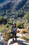
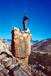
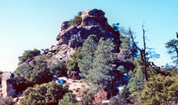
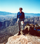
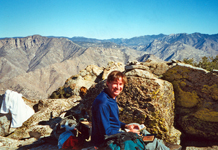
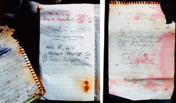
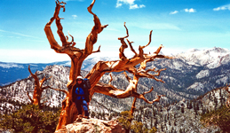
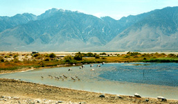
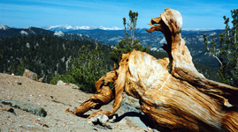
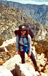
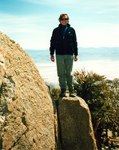
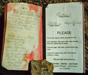
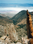
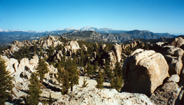
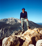
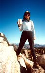
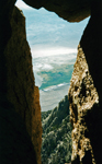
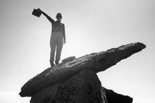
I found many pictures of former peak climbing trips which may be entertaining or even useful for others planning similar hikes. Otherwise they would fade into oblivion. Most of them are from former listed or private peak climbs throughout the Sierra Nevada. I have ordered them roughly by regions but do not claim completeness or all SPS peaks, just showing some selected cases. Short trip descriptions are added from memory or other write-ups. All old pictures are scanned photographs, hence do not have the same quality as the present digital pictures. The southernmost SPS peak is Pilot Knob South, accessible from Hwy 178 between Canebrake Rd and Onyx. One had to ask for permission to pass through Indian Reservation territory. In later years the owners denied access and the peak is now no longer on the SPS List. The peak is still accessible if one makes a long XC trip from the north. It was a very easy day climb. SMS member Susan Livingston also "collected" SPS peaks and accompanied me on Nov. 8, 2000. We passed through the farmer's land and thanked them with some sweetness from the city, then ascended a long gully to the ridge. The summit boulder was an easy climb. The peak register went back to 1957. It had mainly signatures of List afficionados. The view was nice but it felt more like a desert peak than a Sierra peak. Still it was fun for a day. |
Pictures (click for large version):
|
|
|
|
|
|
|
|
|
|
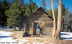
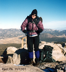
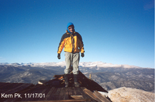
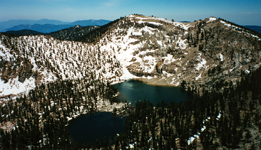
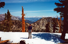
Another peak we hiked together was Kern Peak, in the middle of the Southern Sierra N.F. It was in November, some snow on the ground and very cold and windy on the peak. We passed Casa Vieja which was closed. After a long hike we reached the Kern Peak. There was a platform on the summit, probably used for communication purposes. Even bundled up one could not stand it for too long on this exposed peak. Thus we signed in and turned around. On the way back the sun warmed us and the trees provided some wind shade. This hike should not be done in a real winter storm. |
Pictures (click for large version):
|
|
|
|
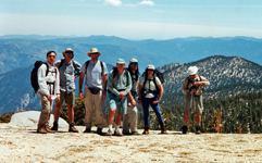
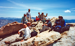
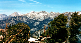
Angora and Coyote are at the southernmost end of the Great Western Divide. These peaks make a fine trip in spring time. An SPS trip was led by Harvey Ganz and Randall Danta with 6 participants. Since the distance is significant it was an overnight trip over the Memorial Day weekend in 2001. The weather was beautiful. The most scenic area was the Coyote Ridge. There were still significant patches of snow which slowed down the hiking. A slow leader and a fast hiker expressed their emotions but were appeased by Randall. We all made it up to Angora Peak and enjoyed a fine view on a splendid day. |
Pictures (click for large version):
|
|
|
|
|
|
|
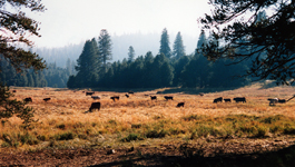
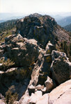
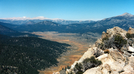
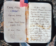
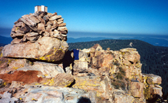
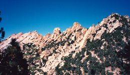
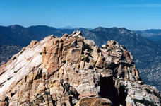
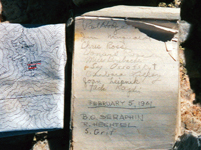
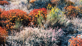
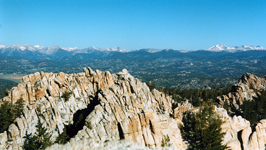
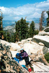
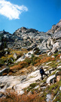
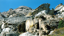
Spring and Fall are the best times to visit the Southern Sierras, since summer is too hot and in winter most access roads are closed. In October 1998 I did a solo trip to climb Smith, Crag, Siretta and Lamont. The meadows were turning brown, there were no people, no mosquitoes. The days were short and it was necessary to move fast to reach the remote peaks like Crag. This peak was a fine cl 3 climb, most of the others were class 2. On Oct. 3 I summited Smith at 9am and Crag in the afternoon. Siretta was climbed the next day at 8:45 am, then came a long drive to Canebrake Road to do Lamont on Oct 4 in the morning, driving home in the afternoon. Nice weather and four new peaks made it a rewarding trip. |
Pictures (click for large version):
|
|
|
|
|
|
|
|
|
|
|
|
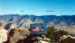
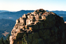
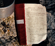
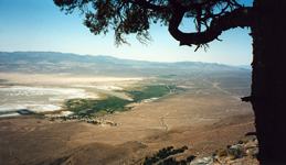
On the east side of the Southern Sierras there are several fine peaks to climb such as the Spanish Needle, Owens Pk, Olancha Pk, Muah and Cartago. Olancha has been described elsewhere, so a short report of a 2-day hike to climb Muah and Cartago is shown here. Susan Livingston and I did a traverse of both peaks from Horseshoe Mdws to Olancha, leaving one car at each trailhead. On June 10, 2000, we hiked to Trail Pass, continued along the PCT and made a XC ascent of Muah. We camped out and continued next morning to Cartago. It is a pretty but confusing area of rock outcrops, one of which is an SPS peak. Instead of trying a dozen climbs the correct peak was located by GPS and climbed successfully. Wonderful views and an old register were the rewards. Then we descended 5,000' straight down the eastern Sierra slopes toward Cartago. It was progressively getting hotter and hotter. Not a drop of water anywhere in this cactus country. After many hours we had made it to the LA Aqueduct, but it was fenced up. Slightly dehydrated we arrived at the Ranch House where we revived. |
Pictures (click for large version):
|
|
|
|
|
|
|
|
|
|
|
|
|
|
|
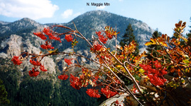
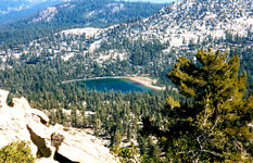
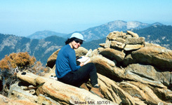
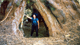
On the west side of the Southern Sierras there are two prominent peaks which are frequently climbed, North Maggie and Moses. It makes a nice weekend trip. Susan Livingston and I hiked both these cl 2-3 peaks on October 6-7, 2001. Late in the year it is not so hot as in summer, the crowds are gone and the mosquitoes dried up. We did easy Maggie on the first day, and the better Moses on the second day. In addition one can see the giant sequoia trees. Autumn colors were also pretty. |
Pictures (click for large version):
|
|
|
|
|
|
|
|
|