
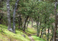
![]() In the US the long distance trails are the Appalachian Trail (AT), the Continental Trail (CT) and the Pacific Crest Trail (PCT), with typical lengths of 2000-3000 mi. The PCT starts at the Mexican Border (Campo) and ends a bit into Canada (Manning Park). It passes through California (about 1700 mi), Oregon (500 mi) and Washington (500 mi). It goes from one mountain range to the next, passes through low and high deserts, snow-peaked mountains, crosses wild rivers, deep valleys, but contrary to its name it never goes to the Pacific Ocean. The trail is only open to hikers and four-legged companions, but no mechanized vehicles.
In the US the long distance trails are the Appalachian Trail (AT), the Continental Trail (CT) and the Pacific Crest Trail (PCT), with typical lengths of 2000-3000 mi. The PCT starts at the Mexican Border (Campo) and ends a bit into Canada (Manning Park). It passes through California (about 1700 mi), Oregon (500 mi) and Washington (500 mi). It goes from one mountain range to the next, passes through low and high deserts, snow-peaked mountains, crosses wild rivers, deep valleys, but contrary to its name it never goes to the Pacific Ocean. The trail is only open to hikers and four-legged companions, but no mechanized vehicles.
"Thru"-hiking means to finish the trail in one season. This requires a major commitment in strength, determination, time and money, which is not given to everyone. Thus many hikers do sections of the trail in different years until they have completed the entire trail.
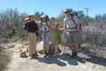
Long-distance hikers have developed their own "culture" or value system, even though there is a considerable variety of people with different views. Perhaps a simplified description is that thru-hiking is the most desired goal, particularly when done in a short time. This creates a competitive spirit which is particularly prevalent among young hikers who would like to test their own and others strength. Extremists have done it in less than 2 months. But strength is only one factor to thru hiking. Others are determination or self-discipline, no accidents, no unforeseen external events, proper planning and luck with the weather which can make the trail impassable by snow or fire closures. Section hikers are often more relaxed, want to enjoy the scenery and avoid the stress. But the fame goes to those who hike the most miles in the shortest time, similar to peak baggers who climb the most peaks as fast as possible or ski the steepest descents as fast as possible. The human nature connects these sports. Peculiar to long distance hikers is that they adopt "trail" names (mine was "Opa") and they look similar due to similar equipment, unshaved faces and certain common manners. Although we hike mostly on our own we gather at similar campsites which forms a group spirit. Socializing is important to most young hikers. "Trail angels" are kind persons who support hikers with water caches and refreshments on the trail. Some angels even provide shelter and transportation at minimal costs. On a PCT hike one experiences real human kindness.
What inspired me to do this hike? No, it wasn't the book "Wild", it was more the idea of going back to some familiar and some new mountains and enjoying the freedom of a long outdoors adventure. In 2013 I finally retired from work, which theoretically gave me the freedom of hiking for up to six months. Admittedly, at age 73 it is a bit late in life to attempt this endeavour. There were many doubtful comments from family members and friends. My doctor put me on the treadmill but admitted there was nothing wrong. Old-timer "Billy Goat" said he never heard of anyone thru hiking at this age. But I was confident that my background in mountaineering and backcountry skiing would help me and I may have a chance to do it. After all, it is only a trail hike similar to the John Muir Trail which I had done earlier. But in retrospect, I did not fully realize what it meant to hike 10 JMTs or 100 Marathons in a row. Leave alone the elevation gain of 450,000' which is equivalent to climbing Mt Everest 15 times from sea level to the summit. The magnitude of this hike produces wear and tear which does not arise on shorter backpacking trips. The equipment has to be as light as safely possible, the body must be fed continuously since one burns 4000 cal daily.
After announcing my New-Years resolution of a long-distance hike I started to prepare in January by collecting information, reading, purchasing light-weight gear and food for dozens of resupply parcels, getting maps and all required permits and I did many 10-20 mi practice hikes in the local mountains.
 April came soon and suddenly it was time to leave. Since it was a dry year I left on April 10, earlier than the kick-off meeting near the end of April.
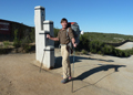
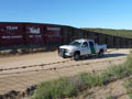
My better half accompanied me to Campo at the Mexican border where the trail starts. The area is heavily patrolled because of illegal border crossings. Although few incidents occur one feels a bit safer at a few tenths of miles away from the border. When the car was gone and I started to walk alone some doubts came up that one could WALK to Canada. Then I thought "let's try one day at a time and see where I would end up" and this was more comprehensible.
April came soon and suddenly it was time to leave. Since it was a dry year I left on April 10, earlier than the kick-off meeting near the end of April.
My better half accompanied me to Campo at the Mexican border where the trail starts. The area is heavily patrolled because of illegal border crossings. Although few incidents occur one feels a bit safer at a few tenths of miles away from the border. When the car was gone and I started to walk alone some doubts came up that one could WALK to Canada. Then I thought "let's try one day at a time and see where I would end up" and this was more comprehensible.
 The first day (Thur, 4/10) I did a 20 mile hike to Lake Moreno. It also involved a steep climb out of Houser canyon during the hot afternoon sun. Many fellow hikers camped in the same area at Lake Moreno campground.
After a good night's rest I started on Fri, 4/11, at 7 am toward the next destination, Mt Laguna. Several of us camped at a pretty Kitchen Creek after an 18 mi hike. Next day we arrived early at Mt Laguna where I picked up my first resupply parcel at the local store, then continued hiking to PCT trail mile 56 at a campsite among boulders which gave some protection from the strong desert winds. Water was always scarce and it was necessary to carry 1 gallon.
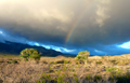
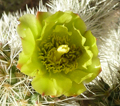
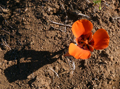
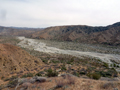
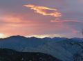
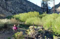
 On Sun, 4/14 I started hiking at 6:30am through the Anza Borrego Mtns. Many cacti were blooming. After nearly 2000' drop I reached Scissors Crossing (mi 77) and camped near noisy Hwy 78 in windy and cool weather. On Sun, 4/15, there was a red sunrise which often predicts a cloudy or rainy day. Indeed, a few hours later the clouds rolled over the Cuyamacas and virgo rain fell in the desert, creating a rainbow which did not reach the ground. I climbed up into the Felipe Mountains greeted by high winds and a few raindrops. After a 17 mi day I camped near the trail among the chapparel to get some protection from the desert winds. The wind carries fine dust grains into any openings of the tent, even the mesh nettings.
 On Mon, 4/15, it was windy, chilly and occasionally raining. At the end of a 17 mi day I camped early at mi 94 again in the chapparel. It is advisable to go slow in the first week or two to avoid getting blisters or injuries. At night I spotted a flickering light on the horizon, which came from a wildfire. I was aware of the consequences: A fire in windy weather moves faster than one can hike and there is no escape from the trail through impenetrable chapparel. Thus, all I could do is to watch and hope, which cost me many hours of sleep. Luckily, it fizzled out and I got still some sleep.
 The next day's destination was Warner Springs where I picked up a resupply parcel and continued hiking in the afternoon since the hot spring was closed. At mi 115 there was a nice campsite next to the Agua Caliente Creek where several hikers gathered. The younger ones smoked pot.
On Wed morning, 4/17, it was below freezing but the wind had calmed down. The next water source was 12 mi away. There was a trail angels cache on the way which contained some beer. It is so tempting but afterwards one gets so tired that it is better to save the pleasure for the evening. I camped that evening at mi 132 next to the trail. The feet are always black from the desert dust but water is too precious to use for washing. Yes, after a week onthe trail, we hikers badly needed showers.
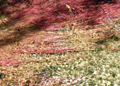
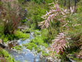 On Thur, 4/18, there was no water shortage. There were creeks in green canyons and wildflowers were in bloom. It was a fine day of hiking and I covered 21 mi to trail mile 153. I partly hiked with some familiar and some new hikers.
Fri, 4/19, I hiked with Gavin into the San Jacinto Mountains. There was a spring 500' off the trail (Live Oak) which had abundant cold water for drinking and cleaning up. I carried 3 liters along to the next water hole. I camped at mi 169 (Apache Spring), but had a bad night since the desert wind picked up and blew the tent full off fine dust. It penetrates even through the tent mesh. Unfortunately, some dust grains ended up inside my camera which caused spots on all subsequent pictures.
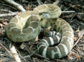
 On Sat 4/20, the trail became interesting. It ascended continuously toward San Jacinto. It was constructed on steep rockwalls with views down into the low desert. At one gully I heard a rumbling sound, suspected an animal, but instead a sizeable rock tumbled down. Such rockfall is created by melting snow at the top of the gully. It can create a major injury when hit. In this terrain it is not a good idea to wear earphones and listen to music. One can also miss the sound of rattle snakes when listening to loud music. We passed Saddle Junction (mi 180) and descended Devils Slide to Idyllwild. There we met many other PCT hikers. On Sun, 4/21, we had a "zero" day of no hiking where we showered, washed clothes, went shopping, ate rich burgers, burritoes, milkshakes and had of course lots of beer. Cell phones and computers connected us again to the "real" world.
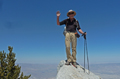
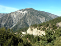
 On Mon, 4/22, we got a ride from Idyllwild to the Humbert Park trailhead, where we ascended the Devils Trail back to the PCT. Gavin and I decided to do the detour to San Jacinto summit. Being on the summit was worth the effort since the view from 10,834' was spectacular. There was still plenty of snow on north-facing slopes. We could also look down to Hwy 10 in the low desert (1,335') which we would have to cross. This required a 9,500' drop most of it along the Fuller Ridge. Since it was too much for one day I stayed on the lower Fuller Ridge at mi 190 where others also camped.
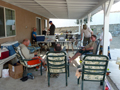
 Tue, 4/23, I hiked down into the low desert, crossed the I-10 and the railroad tracks, passed through Cabazon and arrived at the home of the famous trail angels "Ziggy and the Bear". There were almost a dozen hikers taking a break. We were treated to a footbath, took showers, washed clothes, were served a healthy salad and lots of ice cream, signed a trail register, and sozialized till late at night.
 On Wed, 4/24, many of us hikers left Ziggy and the Bear's oasis to climb into the San Gorgonio Wilderness. We ascended dry mountains, dropped into river washes with streams (Whitewater River), reclimbed ridges and ascended along a green canyon (Mission Creek). After 22 mi I camped at mi 232 near running water.
On Thur, 4/25, it started with a significant climb from Mission Creek to Onyx summit (8553'). On the way the trail passed right next to cages with "wild" zoo animals such as a grizzly, lion and wolf. The roar can frighten you in the otherwise quiet nature. The next day, Fri 4/26, I made it to Baldwin Dry Lake from where one can hitch-hike to Big Bear City for another resupply and zero day. I had pizza and beer with friends, e-mailed and cell phoned.
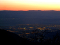
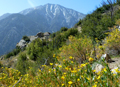
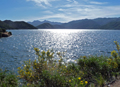
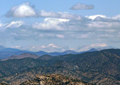
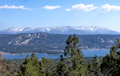 On Sat morning, 4/27, I got a late start since my promised ride back to the trailhead did not materialize. By 10:30 am I hiked up to the Cougar Crest which offered a grand view over Big Bear Lake and the San Bernardino Mountains including San Gorgonio which still had significant snow patches. The day ended near Holcomb Valley on an improvised campsite close to the trail.
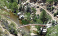 On Sun, 4/28, the hike lead from Holcomb Valley to the Deep Creek. The earlier trail closure had been canceled since the bridge across the creek had been repaired. I passed the 300 mi marker and met many hikers heading for the hot springs. After a 20 mi day I set up camp and enjoyed a dip into the creek.
On Mon, 4/29, I continued the hike along the creek. By midday I took a break at the hot pools where many others enjoyed to swim and sunbathe. In the afternoon I hiked to the Mojave River Spillway, crossed Hwy 173, found an abundant cache of water which lasted till 7 pm where I found a nice campsite at mi 322.
On Sun, 4/28, the hike lead from Holcomb Valley to the Deep Creek. The earlier trail closure had been canceled since the bridge across the creek had been repaired. I passed the 300 mi marker and met many hikers heading for the hot springs. After a 20 mi day I set up camp and enjoyed a dip into the creek.
On Mon, 4/29, I continued the hike along the creek. By midday I took a break at the hot pools where many others enjoyed to swim and sunbathe. In the afternoon I hiked to the Mojave River Spillway, crossed Hwy 173, found an abundant cache of water which lasted till 7 pm where I found a nice campsite at mi 322.
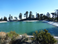
 On Tue, 4/30, I started hiking at 6:15am toward Silverwood Lake, a large man-made reservoir. At mi 323 trail anngels had left a wonderful cache of refreshments: apples, oranges, plums, sodas, power bars, all one dreams about on a long hike. Trail angels are so wonderful! The PCT makes a long contour around the lake, then climbs over the Cleghorn Ridge and drops down to Interstate 15 at Cajon Pass. Closeby is a McDonald where most hikers gather for burgers and milkshakes. Nearby is also a Best Western Motel where some of us stayed to clean up and spend the night.
After a sumptuous breakfast in the motel I hiked out on Wed, 5/1, admired several long freight trains at Cajon Pass and then proceeded to climb for many miles along the obvious San Andreas Rift. There was another fine cache at Lytle Canyon. Then the trail steeply ascended the Blue Ridge where I found a campsite near Guffy's Campground. I was pretty tired from the long day (23.5 mi, 5300' gain). At night it became again very windy and cold.
 On Thur, 5/2, the trail crossed the Mountain High Ski Resort and crossed Angeles Crest Highway 2, from where I hitch-hiked to Wrightwood arriving at 9 am. I picked up my resupply package, ate a sumptuous breakfast together with other PVCTrs and decided for a rest day at the Pines Motel. After the usual chores of a zero day I was looking forward to the trail. Next morning the Motel manager gave a ride to five hikers to the PCT crossing at Hwy 2 from where we headed to Vincent Gap, followed by a long and steep ascent of Mt Baden-Powell (9,402').
 We had lunch on the summit, which included fresh orange juice cooled with local snow, and took pictures of people and the San Gabriel Mountains which we would traverse next. It was a roller coaster trail over the crests of several peaks, Burnham, Throop, Hawkins, etc. By 5 pm we camped at Little Jimmy's campground (mi 384) which had nice spring water.
 On Sat, 5/4, we started at 5:45 am. The PCT was modified due to the "Endangered Species Detour" such that we hiked many miles along Hwy 2, until we could rejoin the PCT at Cloud summit. Passing through Camp Glenwood we met a work party refurbishing a cabin, and were offered beer for our lunch. Later we passed the 400 mi marker, continued to Sulfur Springs and Fiddle Springs (mi 411) where Mark, George and I made camp while Ken and Spitwalker continued on. It was a 26 mi day for me and I felt it.
 On Sun, 5/5, we first filled up water at Fountainhead Spring and then descended to the Mill Creek Firestation which had a faucet with ample fresh water. Then we hiked along Gleason Road (mi 419-431) as a recommended alternate route to the PCT which was infested by Poodledog bushes which grow in burn areas. These plants can produce skin rashes worse than poison oak. At Messenger Flat we rejoined the PCT. It got windy, foggy and drizzling. The station fire had left a terrible devastation for many miles. We passed burnt Messenger Campground and proceeded to N Fork Ranger Station (mi 436) where we set up camp in the rain in a fenced horse stable, minus horses of course. It rained intermittently and hardly felt like springtime. But I slept well after this 25 mi day.
 On Mon, 5/6, we descended into the low desert. It was a long hike in initially windy and rainy weather. In the afternoon I crossed busy Hwy 14 and passed through the exotic Vasquez Rocks until reaching Agua Dulce and the wonderful "Hikers Heaven" of the Sauffleys. I received my resupply parcel, showered and washed clothes, then went with a group of hikers to a Mexican dinner and had a great time. At night we slept under large tents since the rain came back. The next morning, 5/7, we got a ride at 9:45 am to the trailhead. The hike went repeatedly from ridge to canyon with some delightful surprises of trail angels caches. After 18 mi I made camp at mi 473.
On Wed, 5/8, I awoke in a whiteout. Everything was moist which made the pack heavy. At the Ranger Station in Francisquito Cyn I added another 3 l water, skipped the detour to Casa de Luna, continued parallel to the San Andreas Fault to mile 494 where I camped at the end of a 21 mi day.
 On Thur, 5/9, I made the descent into the low desert with destination "Hikertown". I passed the 500 mi marker, another confidence builder. I enjoyed to hike on north-facing mountain slopes covered with fresh green miners lettuce. By 5:30pm I crossed Hwy 138 and checked in at Hikertown where I got my own trailer as a home. There was my resupply packet, a fine dinner, beer, showers, laundry, recharging the electronic gadgets, all what a hiker needs. The hosts were wonderful and the pack of big dogs friendly.
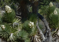
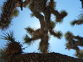
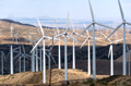 After a good breakfast I started on Fri, 5/10, at 8 am. A straight dirt road lead to the LA Aqueduct, along which we followed. It was hot, windy and little shade from some Joshua trees. After 10-15 mi I entered endless windmill farms. There was no water and no good camping sites. I carried 3 l with me and there was luckily a nice water cache at dry Cottonwood Creek, set up by the Hikertown angels. At the end of a 20 mi desert hike I set up tent in the wind shade of desert bushes among quietly rotating turbines. Surprisingly I could cell phone inside my tent out in the boondoggle.
 On Sat, 5/11, I continued the hike into the Tehachapi mountains. At Tylerhouse Creek I pumped 3 l water for the next 16 mi of dry trail. At Willowspring Road I hitched a ride in 30 min which brought me to the Best Western Mtn Inn in Tehachapi where I stayed for two nights. It is only a 3 hour car ride from LA so my wife came for a visit and brought my resupply parcel. We had a great time eating in different restaurants, shopping and celebrating Mother's Day, Sun, 5/12,. But all good times end and Mon, 5/13, I started hiking again. My 3 l of water in the pack were barely enough for the 19 mi stretch with a climb to 5000'. I had to ration water for dinner and breakfast and promised myself to carry more water next time.
 On Tue, 5/14, I started early at 5:30 am, made it quickly to Golden Oak Spring which had a great flow of cold spring water and filled 4 1/2 l of water for the coming 20 mi hike through burnt forests and hot dry mountains with lots of ups and downs. The wind farms never seemed to end. After 20 mi I camped at mi 577 on some flat piece of earth which apparently had also been used by cows.
Wed, 5/15, sounds like a repeat: Hiked at 5:30 am, pumped 5 l of water at Robin Bird Spring, continued to Landers Meadow, Kelso Valley, crossed Butterbred Cyn Road and climbed up into dry, hot and windy hills. At mi 620 I camped in the windshade of a stand of Joshua trees. The only visitor was a tall desert jackrabbit. Thur, 5/16, was not too different. I hiked by 5:45am to mi 622, where I made a detour to Willow Springs which had an abundant flow of excellent spring water. I carried 4 l on my way up to Skinner Pass. It became very windy and cloudy. At 6 pm I found a sheltered campsite near the Yellow Jacket spring trail. With detours it was again a 20 mi day. At night I called my son to confirm a meeting next day at Walker Pass.
On Tue, 5/14, I started early at 5:30 am, made it quickly to Golden Oak Spring which had a great flow of cold spring water and filled 4 1/2 l of water for the coming 20 mi hike through burnt forests and hot dry mountains with lots of ups and downs. The wind farms never seemed to end. After 20 mi I camped at mi 577 on some flat piece of earth which apparently had also been used by cows.
Wed, 5/15, sounds like a repeat: Hiked at 5:30 am, pumped 5 l of water at Robin Bird Spring, continued to Landers Meadow, Kelso Valley, crossed Butterbred Cyn Road and climbed up into dry, hot and windy hills. At mi 620 I camped in the windshade of a stand of Joshua trees. The only visitor was a tall desert jackrabbit. Thur, 5/16, was not too different. I hiked by 5:45am to mi 622, where I made a detour to Willow Springs which had an abundant flow of excellent spring water. I carried 4 l on my way up to Skinner Pass. It became very windy and cloudy. At 6 pm I found a sheltered campsite near the Yellow Jacket spring trail. With detours it was again a 20 mi day. At night I called my son to confirm a meeting next day at Walker Pass.
On Fri, 5/17, after a cold and windy night, it was an easy hike down to Walker Pass where I arrived by midday. I settled down at the campground and found a nice food and water cache from trail angels. I relaxed in the afternoon and met my son in the evening at Walker Pass. He prepared a great barbeque dinner and we feasted into the darkness. More PCT hikers were at the campground and we had nice conversations. Next morning, Sat, 5/18, we had a nice breakfast with scrambled eggs, coffee, sweets, fruits and left by 8:30 am. I hiked up to Owens Peak Saddle, passed by Joshua Tree Springs without the detour to the spring, and ascended the long uphill trail to Spanish Needle. On the way we found water on the trail and "cameled" up 4 1/2 l for dinner and breakfast. I hiked with Jersey and we camped at mi 673 near the ridge. It was a 22 mi day with a 5,000' climb.
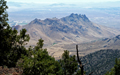
 On Sun, 5/19, I hiked from the Spanish Needle Saddle past Lamont Peak/ Mountain to Chimney Creek and Lamont Meadow. There was a superb cache with beer cooled in the creek. I carried it for dinner since one gets too sleepy in the midday heat, especially on the long climb to Fox Mill Spring where the next water source was. I met Dora as we hiked down through miles of burnt terrain to Rockhouse Basin and Manter Creek where we camped. From there it would be an easy hike to Kennedy Meadows next day. Hiking through the Southern Sierras brought up so many memories of I had fond memories of previous SPS peak climbs such as Owens Pk, Spanish Needle, Lamont, Crag, Smith, Carthago, Muah, Trail, Rockhouse, Taylor Dome, Olancha, etc, etc.
On Mon, 5/20, Dora and I hiked out by 6 am toward the Kern River, the first real big river with unlimited water supply. We arrived at K.M. in time for a burrito breakfast, met many hiker friends, I got my resupply parcel, a nice cabin, cleaned everything, played with the dogs, even had a game of chess with friends. K.M. is usually known as the entry point to the High Sierras, the more difficult section of the PCT. Thus I and others decided to have a rest day before embarking into the Sierras. We mostly loafed, ate and drank on Tue, 5/21, but also communicated with the available computers, I tried my new trail runners with micro spikes on and finalized packing, which now included the required bear canister. When it got dark a cowboy movie was shown in the amphitheater.
This report continues as "Part 2: The Sierra Nevada, May-June 2013".
Go on to Part 2
Go on to Part 3
Go on to Part 4
Go on to Part 5
Back to Trip Reports
Back to SMS Home Page