
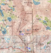
The Inconsolable Range is located north of the Palisade Range. Its rugged west face is frequently photographed but rarely climbed.
 The range can be accessed from the east via the North Fork of Big Pine Creek, from the north starting near South Lake or the west from the Bishop Pass trail. After skiing and climbing in this area for a while it may be useful to summarize the trips and routes for possible future outings.
Cloudripper (13,525')
This is the highest peak of the Inconsolable Range and the only peak in the range that is on the SPS List.

 The standard routes are either from the south via Seventh Lake or from the north starting at Parchers Camp, via Brown Lake and Green Lake. The latter approach is described in a trip report of an earlier SMS ski trip (Cloudripper, April 1999).
Aperture Peak (13,265')
In 2003 the SMS scheduled a summer trip and climbed various peaks, among them Aperture Peak (Columbine et al, July 2003).
 We camped at the Bishop Lakes, climbed Jigsaw Pass and from there the north slopes of Aperture Pk as a dayhike.
 It was a fine class 3 peak climb, but ended with a big thunderstorm. We found only an improvised summit register in a small glass jar. A year later we located the real one on a pass south of the peak (described below).
Picture Puzzle Peak (13,276')
This peak is located a mile southwest of Cloudripper, considerably more difficult to climb and probably not suited for a ski trip. In August 2004, SMS member Barbara Berne and I climbed this peak (Picture Puzzle, Aug 2004).

 There are only two class 3 routes to the summit: A long and jagged north ridge route from Ruwau Lake or a 40-deg gully on the east side from Fifth Lake via the Big Pine Creek drainage. We ascended the N Ridge and descended part of the gully, returning lower over the ridge to Ruwau Lake.
 There was no snow in the E gully, otherwise we could not have climbed down without ice axe and crampons.
 On the way down toward Ruwau Lake we made a detour and climbed Chocolate Peak (11 362440E, 4111945N, 11,682'). This is a class 1 peak with exotic colors of red, white and black.
This made a great day of peak climbing.
On the way down toward Ruwau Lake we made a detour and climbed Chocolate Peak (11 362440E, 4111945N, 11,682'). This is a class 1 peak with exotic colors of red, white and black.
This made a great day of peak climbing.
Gendarme Peak (13,241')
On Sep. 26, 2004, I soloed over Jigsaw Pass and climbed Gendarme Peak. Climbing the pass (see below) is more challenging than the peak itself. The west ridge is class 2 but near the summit it turns into easy class 3.
![]()
 Since there was new snow on the rocks I stayed slightly north and below the ridge. From the summit one can see at least four impressive rock columns to the east, the Gendarmes. A traverse along the east ridge toward Two Eagle Peak is at least a class 4 climb. The summit register is in a glass jar with a spiral notebook dating back to Aug 1978, averaging less than one entry per year. From the summit one has a fine view of the Palisade Range, the Inconsolable Range and the lakes of the North Fork of Big Pine Creek.
Peak 13,218'
This peak is located at UTM 11 363446E, 4109760N about 0.1mi south of Picture Puzzle Pk. It is almost as high as the latter. From the Bishop Lakes area, it appears to be the most prominent and impressive peak of the Inconsolable Range.

 Surprisingly, it is not marked on the Mt Thompson topomap. I climbed it from the east which involves a steep climb on loose talus blocks. It is easy class 3 but the challenge is to find stable rocks. It is like climbing a steep moraine.

 The summit views were outstanding: To the west is a near-vertical dropoff toward the green Bishop Lakes. To the north is the rugged cl4 south face of Picture Puzzle Pk. To the east is Gendarme Pk and in the south looms the high Palisade Range. I descended carefully and continued the ridge south toward Jigsaw Pass.
Peak 13,054'
After descending Peak 13,218' the next high point south
 is at the west end of the ridge from Gendarme Pk (11 363677E, 4109579N, 13,054'). Again, this peak is not marked on the topomap but it is clearly visible from the Bishop Pass trail. I rebuilt an old cairn but saved my last register for the next peak south, Peak 12,856'.
Peak 12,856'
Although not a particularly outstanding peak it is marked
 on the North Pal topomap (11 363717E, 4109374N) and it is visible on the crest when viewed from the Bishop Pass trail. It is the first significant peak north of Jigsaw Pass. Only because it was marked on the topomap, I left my last peak register on this peak.
Jigsaw Pass (12,756')
This pass is probably the best route to cross the Inconsolable Range from the Bishop Lakes area to the Big Pine Lakes area. When viewed from the Bishop Lakes or from Bishop Pass one can see several chutes north of Mt Agassiz. It is the third chute from Agassiz where a white diagonal rockband comes down on the moraine.

 There is a duck-marked use trail that starts at Bishop Pass (11 362802E, 4108545N), goes east and ends at the moraine (11 363484E, 4108746N, 11,998'). A short scramble across the moraine leads to a talus fan at the base of the chute that goes up to the pass. One can barely see the wooden post at the top of the pass (11 363864E, 4109119N). The chute is a 700' class 2-3 climb with many loose rocks. The east side is much easier. There is a pass register next to the wooden post. Temporarily the peak register for Aperture Peak is deposited at the pass, which is the best starting point to climb Aperture Peak.
Pass 12,941'
This pass is at the boundary between the Palisade Range and the Inconsolable Range at 11 364045E, 4108565N. It is reached by a wide scree chute just north of Mt Agassiz. It provides a XC route between the Bishop Lakes area and the Sam Mack Lake area.
 While the west side of the pass is class 2, the east side is steep and probably filled with snow for most of the year except late summer. It drops down to the glacier and moraine between Agassiz, Aperture and Robinson. From the pass an ascent of Agassiz or Aperture would be a class 4 adventure.
On Sep 4, 2004, returning from a trip to the Black Divide (Peak 12,774', Sep 2004), SMS member Leslie Hofherr and I explored this area. We traversed over Pass 12,941', descended NE on the moraine, circumnavigated Aperture Pk and returned over Jigsaw Pass. On Pass 12,941' Leslie found the SRC peak register for Aperture Pk. The 10-year old register contained only one signature from a 71-year old man who wanted to deliver it to the peak but may have mistaken Pass 12,941' with Jigsaw Pass and could not climb Aperture Pk from there. We brought the register to Jigsaw Pass with a note for the next climbing party to bring it to the summit of Aperture Pk. A month later it was still there.
Back to Trip Reports
Back to SMS Home Page