
|
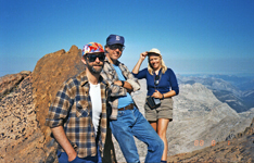
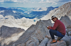
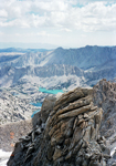
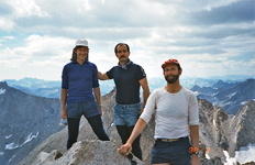
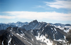
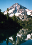
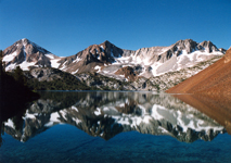
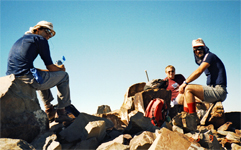
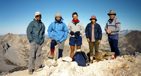
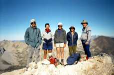
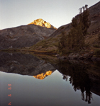
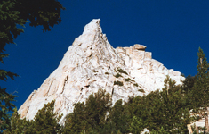
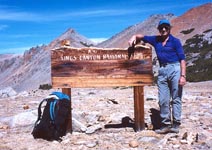
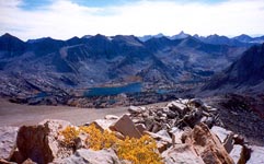
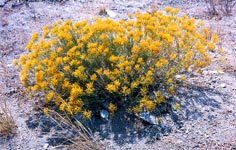
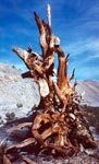
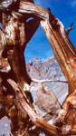
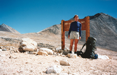
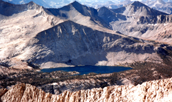
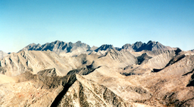
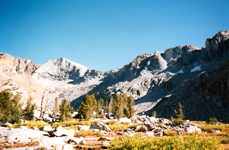
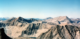
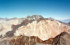
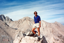
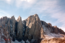
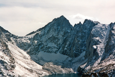
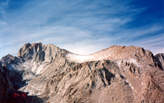
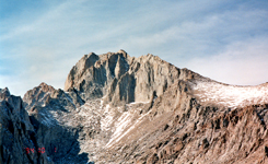
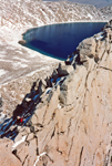
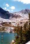
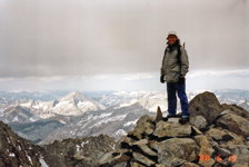
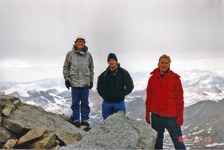
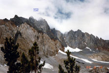
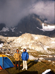
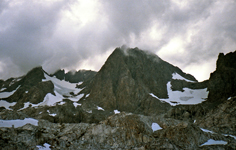
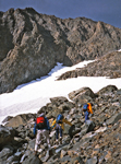
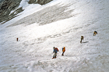
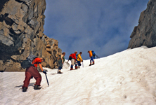
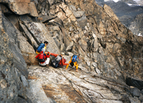
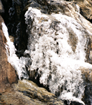
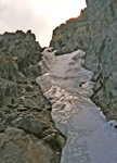
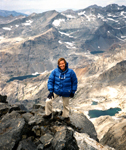
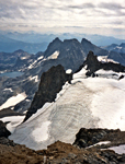
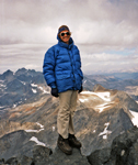
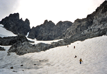
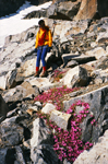
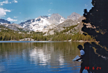
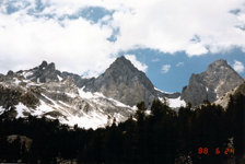
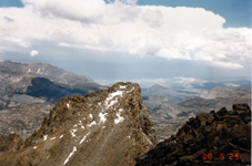
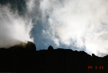
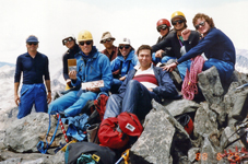
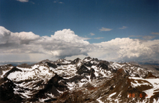
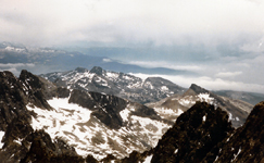
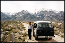
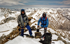
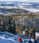
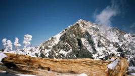
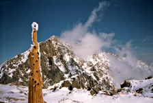
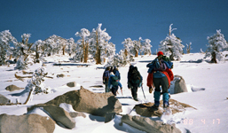
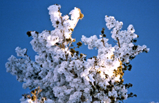
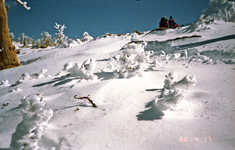
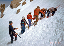
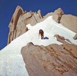
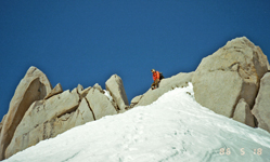
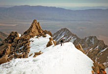
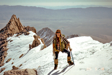
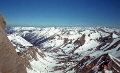
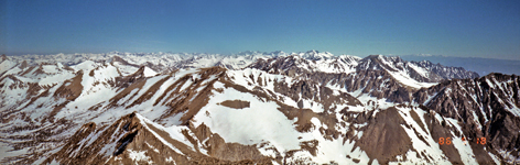
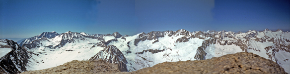
I found many pictures of former peak climbing trips which may be entertaining or even useful for others planning similar hikes. Otherwise they would fade into oblivion. Most of them are from former listed or private peak climbs throughout the Sierra Nevada. I have ordered them roughly by regions but do not claim completeness or all SPS peaks, just showing some selected cases. Short trip descriptions are added from memory or other write-ups. All old pictures are scanned photographs, hence do not have the same quality as the present-day digital pictures. Haeckel and Wallace This was an SPS trip on July 31-Aug 1, 1988. Ken Duzy and myself led a group of 8 hikers from Lake Sabrina (Bishop Creek) into the beautiful backcountry around Moonlight Lake. We climbed both peaks, as described in a copy of a trip report. We had thunderstorms, sunshine and an injured hiker, all you can experience on a backcountry adventure. The pictures show more than a thousand words. We had an adventurous weekend. |
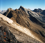
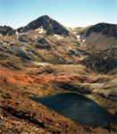
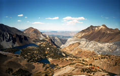
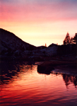
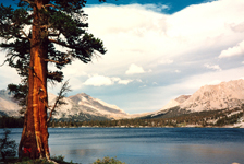
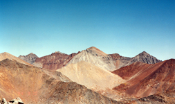
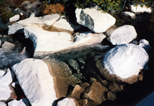
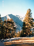
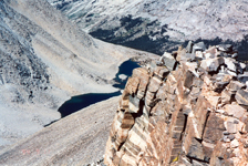
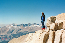
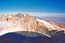
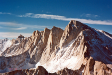
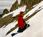
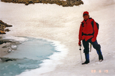
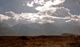
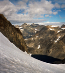
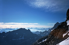
Pictures (click for large version):
|
|
|
|
|
|
|
|
|
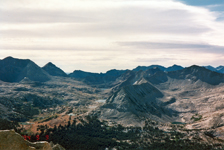
Mt Tom
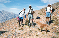
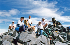
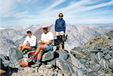
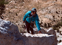
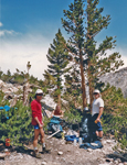
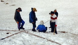
This was a fun trip climbing with dogs. It was jointly scheduled by the SPS and the K-9 section for climbers with suitable dogs. I had a German shepherd, Tatanka, who had previously been on a ski ascent of Basin Mtn, so he should be able to do Mt Tom as well.
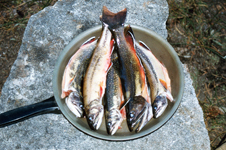
The trip went on Sep 23-24, 1995 and was led by Scot Jamison and Julie Rush and there were four human and three dog participants. I learned a lot about dogs on this hike, that they have also leaders, that size does not matter, but experience does. Dogs can get altitude sickness like people, they need booties to avoid bloody feet on rock, they need plenty of water since they cool only with their tongues.
We hiked up to Horton Lake and made camp. Fishing was good and a trout dinner was a good start for the trip. Early next morning we hiked up the mining road of Mt Tom. The weather was perfect. We all made the summit and had a good rest since it was a long climb. Then we returned the same way. Tatanka did get bloody feet but he was a young strong male who could handle it. Otherwise we had no problems with our four-legged companions. It was a fun trip with best friends.
Pictures (click for large version):
|
|
|
|
|
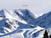
Bloody Mtn
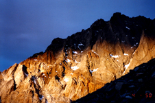
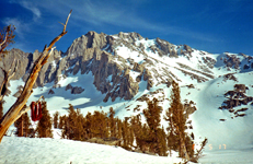
Many of us have seen Bloody Mountain when driving on Hwy 395 south from Mammoth Mtn. In winter it looks very impressive and challenges the skiers to do the Bloody Couloir. But in summer it makes an easier and rewarding day hike. This is what I did on July 27, 1997. I started from Convict Lake, hiked to beautiful Lake Genevieve and climbed the scree slopes to the summit. I looked down the Bloody Couloir chute which still had some snow left. The upper part is STEEP. The views from the summit were great. Nearby Red Slate with its skiable North Couloir was clearly visible. Puffy summer clouds were abundant but no thunderstorms had started yet.
After a nice rest on the summit I hiked down the same way. My favorite place was Lake Genevieve where I would like to return some day for fishing and swimming. The best hikes are usually those which one would like to do again. This was one of them.
Pictures (click for large version):
|
|
|
|
|
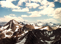
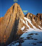
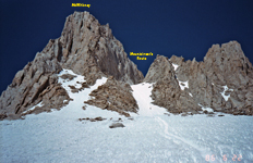
Morrison, Baldwin and Red Slate
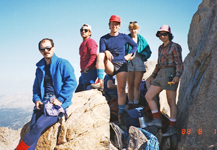
This was a scheduled SPS trip which I lead with Ron Robson as assistant leader and four participants on Sep 2-4, 1989. We climbed three nice peaks on the east side of the Sierras, cl 3 Mt Morrison and cl 2 Red Slate. We started at Convict Lake and made basecamp at Bright Dot Lake. In the afternoon we climbed Mt Morrison via the northwest ridge. Once on the ridge it was an easy scree ascent. The views on a clear Fall day were excellent.
On the next day we first climbed Mt Baldwin, the headed for Red Slate, climbing it via the easy but long west ridge south of Wit-So-Na-Pah Lake. Nice summit views again. The surrounding mountains are bone dry but very colorful, white, red, brown and black. Mt Baldwin is also called Calcite Peak due to deposits of this mineral. After an enjoyable stay on the summit we returned to camp, tired from climbing 6,000' for two peaks in a 12 hr day. Next day we packed up and hiked out. Everyone in the group had a fine time.
Pictures (click for large version):
|
|
|
|
|

|
|
|
|
|
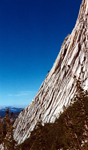
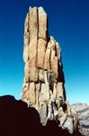
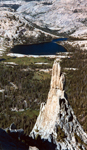
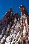
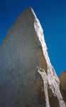
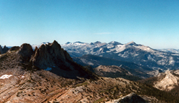
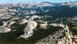
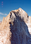
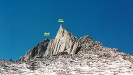
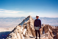
Cathedral Peak
This was a solo climb of a beautiful and challenging mountain in Yosemite N.P. on Aug. 17, 1997. Cathedral is rated as cl 4-5 which requires rope protection which is tricky on a solo climb. The rope is fixed at the bottom which protects you in a fall but there is nobody to lower you if you are injured and cannot downclimb. It is better than no protection but worse than climbing with a partner. In short, you must be very careful and not fall.
I started at Tuolumne Mdws and reached the base of Cathedral in a short time. Unless one chooses the technical route on the east face the main ascent is class 3. The crux is the steep upper summit area. There is a 15' summit block on the SW face which is climbed via crack on the SE face. It is definitely high cl 4 terrain. The climb went well, but the summit register was empty. The peak seems climbed too much and some consider a register a nice souvenir. I rappelled down and soon was in safer terrain for the hike out. It was a great day.
Pictures (click for large version):
|
|
|
|
|
|
|
|
|
|
|
|
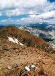
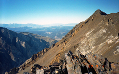
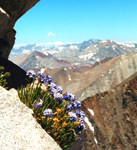
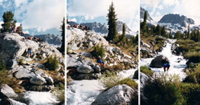
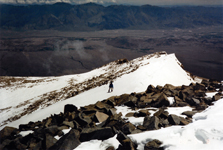
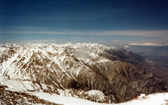
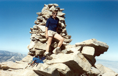
Baxter, Black and Diamond This was a solo climb of three listed peaks in the Eastern Sierra Nevada in early summer, June 28-30, 2000. The first challenge was to climb Baxter Pass, about 6,000' up from the desert floor. The peaks were class 2-3. No snow climbing was involved. It was all XC hiking over a lot of scree slopes. One had to keep a reasonably tight schedule to do the three peaks and the long ascent/descent within three days. Although it is a dry barren landscape there is beauty in the scenery of lakes, peaks and some flowers. It was a worthy climbing experience. It added one more of the classical 6,000' Eastern Sierra ascents (Shepherd, Sawmill, Taboose). |
Pictures (click for large version):
|
|
|
|
|

|
|
|
|
|
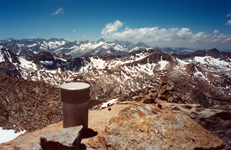
Colosseum
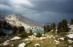
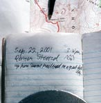
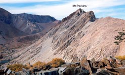
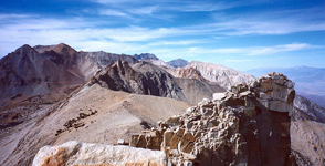
Thanks to the insurance fiasco of the Sierra Club, which forbid scheduled mountaineering trips I developed the habit of solo peak climbs. It strengthened my experience, confidence and the feeling for the "freedom of the hills". Thus, on a short notice I took off on a free weekend (9/21-22/2001) to climb another Eastern Sierra Peak, Colosseum Mtn, and another classical 6,000' trail to Sawmill Pass. Fall or spring are the best times which avoids the summer heat on the long ascent.
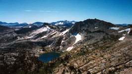
Once one reaches Sawmill Pass (11,347') one has a fine view of Woods Lake to the west and Colosseum to the north. The climb is easy class 2. Admittedly, everything is dry and brown in the Fall, while snow fields add nice white patches to the scenery as we saw on a ski trip to Mt Perkins. Each season has its charm and should be enjoyed. I had a good time on this weekend.
Pictures (click for large version):
|
|
|
|
|
|
|
|
|
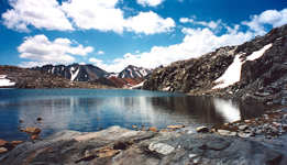
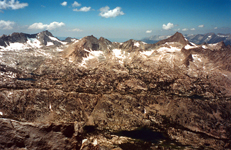
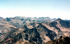
Ruskin, Arrow, Pyramid and Striped
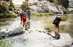
It was a solo hike via Taboose Passon Sep 8-11, 1994. The first day was needed to get over Taboose Pass, a 6,000' climb, and to establish a base camp near Mt Ruskin since I like to climb early in the morning. Mt Ruskin is an SPS Mountaineers peak, with high class 3 climbing, which is exciting and rewarding. So are the views from the summit on a clear Fall day. More details about climbing routes are found in R.J.Secor's guidebook or many websites and trip reports.
After climbing Ruskin in the morning I relocated to a small lake near Arrow and Pyramid, a few miles SW of Bench Lake. Once off the busy JMT I met nobody and it was real back country wilderness where once even a Ranger vanished. The climbs of both peaks went well. Arrow Pk, another SPS Mountaineers Pk, looks impressive from many directions such as from the Cirque Crest or the Muro Blanco. Pyramid was a regular cl 2 peak with fine summit views.
On the last day I was on Striped Mtn, which was climbed on the way back toward Taboose Pass. It is a colorful and pretty mountain, nicer than nearby Goodale. In retrospect the trip was a real joy, the climbs went well, the scenery was pretty, and I enjoyed the good workout.
Pictures (click for large version):
|
|
|
|
|
|
|
|
|
|
|
|
|
|
|
|
|
|
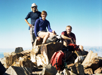
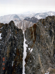
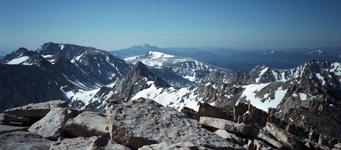
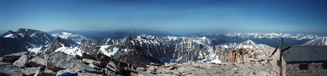
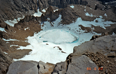
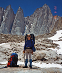
Thor, Russell and Carillon
This was another solo hike on Oct 1-2, 1994 to three fine peaks in the Whitney area. Mt Whitney was not the climbing objective since I had done it several times before. Russell was the crux, Thor a pleasure and Carillon a necessary chore.
The first day I hiked up the North Fork Lone Pine Creek to the Upper Boy Scout Lake which makes a good basecamp for the three peaks. There was enough time to do Thor in the afternoon. From the summit (12,306') one had a splendid view of the east face of Mt Whitney (14,505') and of Russell to the north and McAdie to the south. It was a fine start of the trip.
The next day I headed up to the Russell-Carillon Pass to climb both peaks. The east ridge of Russell looked a bit intimidating, especially with some snow coverage. But after a deep breath I started the climb. Getting over the false east summit was exciting, as was the long traverse to the higher west summit (14,086'). A slip on the ridge was not an option, so I climbed carefully taking my time. Another climber joined the fun and we both made the summit.
After getting down from Russell's east ridge I continued the easy walk up to Carillon (13,552'). The views of the east face of Whitney was very photogenic. I hiked down, packed up and descended via the Ebersbacher ledges to the Whitney main trail. It ended a great weekend of climbing.
Ten years later, we revisited this area and climbed several nearby peaks such as Carl Heller, The Cleaver and Tunnabora. Quite a different experience is a backcountry ski tour in this terrain, starting at Mt Williamson.
Pictures (click for large version):
|
|
|
|
|
|
|
|
|
|
|
|
|
|
Split Mtn
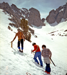
This was a private trip of four members of the Advanced Mountaineering Training Course. Our objective was to practice snow and rock climbing skills and to climb a challenging mountaineers peak on the SPS List. The trip took place on June 17-19, 1988. Participants were John Gleeson, Glenn Davis, Tom and myself. Our ascent route was on the steep east face with basecamp at beautiful Red Lake, which is east of Split and south of Tinemaha.
On the first day we tortured our cars over the rough roads to the Red Lake trailhead, hauled our packs 4,000' up to basecamp at Red Lake (10,500') and acclimatized. The next day we climbed another 4,000' up to the summit of Split Mtn (14,058') but with daypacks. We carried ice axe and crampons for the mixed class 3 rock and snow climb. We started before 5 am and summited by 8:30 am on a cloudy and cold day. As usual, we took summit pictures, signed the register and had something to eat. But it was not a day for relaxing in the sun. The clouds were sinking and we did not want to be caught in bad weather at 14,000' altitude.
The descent on snow was fun, doing sitting or standing glissades, always prepared for an ice axe arrest. But this was not a ski trip as we did later on Birch and Tinemaha. We were back at camp by noon and by now Split was in the clouds. We packed up and continued the long way down to the cars and then drove home. We left with a feeling of accomplishment from this fine climbing adventure.
Pictures (click for large version):
|
|
|
|
|
|
|
|
|
|
|
|
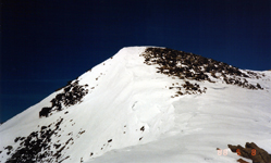
Mt Ritter (BMTC)
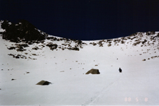
This was one of the four experience trips required for graduation in the Basic Mountaineering Course (BMTC). Leader Larry Cobb lead us up to Mt Ritter in the Fall of 1986. Actually, Larry followed the group and appointed students alternately to lead, which was a great learning experience. We made basecamp near the Nydiver Lakes. In the evening the mountain was engulfed in clouds and the ascent looked questionable. But, unless it is a large weather front, it is usually clear early in the morning which is when we started our ascent into the Ritter-Banner saddle. The objective was to climb up on the steep north face and descend on the gentler southern snow fields.
The climb into the saddle required ice axe and crampons since the snow field was hard and steep. From the saddle we climbed a steep and narrow chute which near the top was filled with ice. Everyone made it safely to the summit (13,157'). The views were great, especially of the nearby rugged Minarets. But there was no sunshine, it was windy and cold and we soon descended on the southern snow field which is an ideal route for backcountry skiing in spring.
The descent went well. When we arrived at camp the mountain was covered in clouds again. We were lucky and very satisfied with this successful climb of an SPS emblem peak.
Pictures (click for large version):
|
|
|
|
|
|
|

|
|
|
|
|
|
|
|
|
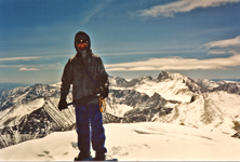
Mt Ritter (AMTC)
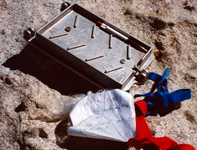
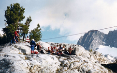
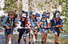
This was an official SPS/MTC sponsored peak climbing trip combined with mountaineering instructions. Bill Oliver was the leader and I was the assistant leader. There were eight participants from our Advanced Mountaineering Training Course (AMTC). The trip was scheduled on June 24-26, 1988, when there was still significant snow in the higher elevations. Ice axe, crampons, helmets, ropes and some hardware were needed. We started from Agnew Meadows, passed Lake Ediza and camped near the Nydiver Lakes for an easy access to the Ritter-Banner saddle. In the afternoon we had a snow anchor practice session, reviewing equalizing anchors, Z-pulley setups and belays. There was also a sizeable stream and I set up a Tyrolean Traverse to cross the stream without getting wet. Maybe the heavier guys got wet feet since the rope stretched under their weight.
Next morning we started our ascent into the Ritter-Banner saddle. For a warm-up we first climbed Banner Pk (12,945') which is an easier cl 2-3 ascent with negligible snow coverage. Strange cloud formations arose on its summit, perhaps leading to its name. It is also a very photogenic mountain when viewed from Thousand Island Lake. After returning into the saddle we ascended Mt Ritter (13,157') via a steep and icy chute. All summited around 1 pm. After lunch Bill entertained us by reading John Muir's account of his climb of Ritter. In the meantime the summer clouds thickened and the first thunder was heard. Finally, at the end of a chapter we descended down the southwestern snow field which makes a fine ski tour. During the descent, around 3 pm, the sky opened up and bombarded us with big hail balls. Now we realized why helmets are vital. But it still hurts on the ears. When we arrived at camp it was all over.
On the hike out we had a last and useful instruction for river crossings. The San Joaquin River was swollen from the snow melt. Instead of individual crossings there is strength in a group. We all lined up parallel to the flow, held the ice axes with interlocked arms, which effectively forms a long and stable pole and marched jointly across the gushing stream. If one slips the rest provide stability. Of course, we all unbuckled the pack belts and we wore boots to reduce slippage on rocks. We all crossed easily and learned a new skill. Thus, it was a fun trip with a fine group of strong and enthusiastic climbers. We all climbed two good peaks, learned more mountaineering skills, had a strong and enthusiastic climber group and no incidents.
Pictures (click for large version):
|
|
|
|
|

|
|
|
|
|
|
|
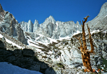
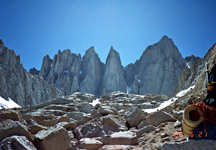
Mt Whitney via the Mountaineers Route
On June 21-23, 1986, Ron Robson, Ali Aminian and myself did a private trip to Mt Whitney, an SPS emblem peak and the highest peak in the Continental USA. It was a BMTC experience climb for graduation of this training course. We had learned the use of ice axe and crampons and surely needed them for the rock and snow climb on the Mountaineers Route.
On the first day we ascended the North Fork of Lone Pine Creek to the Lower and Upper Boy Scout Lakes and finally made basecamp at Iceberg Lake at the base of the Mountaineers Route. As the name says it was a cold place and we did snow camp.
An early start next morning got us up the steep snow chute of the Mountaineers Route. Then we continued a rock climb up a steep chute on the north face of Whitney. Near the top the steep chute was filled with ice and ice axes were needed for support. Reaching the summit was a great reward. The views were outstanding, the weather was perfect, and there were no crowds on the summit yet. We took pictures, ate our snacks, fed the birds and enjoyed the grand views.
The descent down the upper chute was as exciting as the climb. But once on the snow field it was a fun glissade almost down to Iceberg Lake. We packed out and hiked down with a great feeling of a successful climb.
Pictures (click for large version):
|
|
|
|
|
|
|
|
|
|
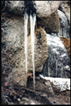
Mt Williamson
On May 7-9, 1988, Ali Aminian, John Gleeson and Reiner Stenzel did a private trip to climb Mt Williamson, an SPS emblem peak and the second highest peak in the Sierra Nevada. We ascended from the east via George Creek, infamous for miles of bushwhacking in XC terrain. In May the upper part of George Creek is a snow climb which makes climbing easier than on rock, provided there is no postholing. We were equipped with ice axe, crampons and snow camping gear.
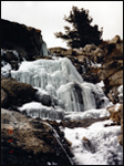
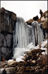
The ascent is long but not difficult. There are cl 3 chutes which connect the upper George Creek with the gentle east ridge of Williamson. Above 14,000' the pace slows down, furthermore it was cold and windy. The views were great and in spite of some clouds there was no threat of thunderstorms or whiteouts. We enjoyed the summit and descended the same way as we ascended. We passed by a frozen waterfall with long icicles. It could have been the beginning of George Creek.
Downhill bushwhacking was a bit easier then uphill. We all made it safely out to the trailhead. Looking back on the 9,000' climb we were not surprised to be tired. But we were glad to have done the trip.
Pictures (click for large version):
|
|
|
|
|
|
|
|
|
|
|
Olancha
This was another AMTC experience hike led by Larry Cobb. It was a snow climb of Olancha Peak (12,132'), an SPS Emblem Peak in the Southern Sierras. Since the trip was scheduled for mid-April (4/16-17/1988) we had unpredictable weather with wind, clouds, snow and sunshine. Since BMTC/AMTC does not teach skiing everyone was on snowshoes. This implies a relatively slow pace, especially when climbing in 1-2 feet of new snow. The upshot was that we got close to the summit but not on the top of Olancha. Nevertheless, it was a great experience in snow travel and winter camping.
We hiked up from the desert floor to Olancha Pass and camped on the plateau. We started watching the clouds drift by, we were in the clouds on the top, it snowed at night and next morning we were in winter wonderland with bright sunshine. We headed toward Olancha Pk, but the effort of climbing uphill through heavy and deep snow even brings enthusiastic climbers down. The timing did not predict that we would reach the peak and be able to return. Thus, we returned, packed up and hiked out. It was an experience trip and we learned a lot, including our limits and respecting mother nature.
In the Fall (10/8/88) I returned under better conditions and summited Olancha in a solo dayhike (20 mi, 6000', 12 hrs). A few years later (3/6-7/2004) we did ski Olancha on an SMS trip.
Pictures (click for large version):
|
|
|
|
|
|
|
|
|
|
|
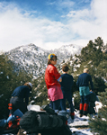
University Peak
This was our third AMTC experience climb led by Larry Cobb with a group of 8 participants. University is a respectable class 3 peak (13,632'), an SPS mountaineers peak, and I chose it for my provisional M-lead trip a year later (7/18-18/1987). It is best climbed with snow, requiring of course ice axe and crampons, rope and some hardware. We were lucky with the weather which was perfect in mid-May (5/17-18/1986).
On the first day we climbed from Onion Valley to Flower, Matlock and Bench Lake where we set up camp and reviewed/practiced ice axe arrest, crampon use, snow anchors and belays. We used map and compass to identify the terrain and the best climbing route for the next day.
Having accomplished the summit we now had to descend carefully. Everything went well. The group packed up and hiked down satisfied with a great outing with top leaders and a strong group of climbers.
Pictures (click for large version):
|
|
|
|
|
|
|
|
|
|
|
|
|