
|
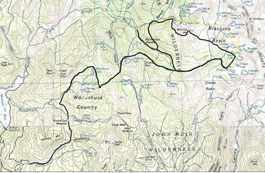
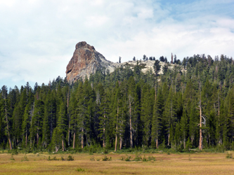
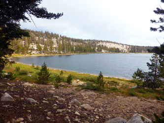
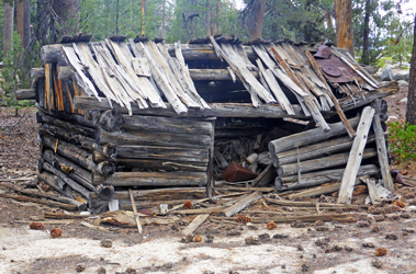
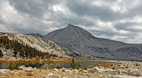
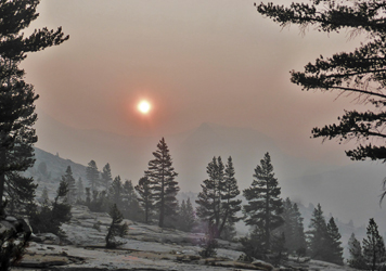
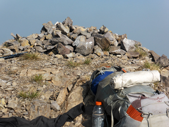
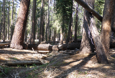
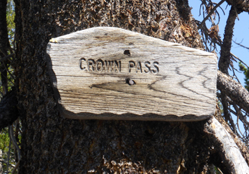
This trip report is not as exciting as some in the past. Over 80 my pace has slowed down. Furthermore, we have a virus pandemic problem where groups can spread the desease. Thus, solo hikes remain an option, which but one misses out some fun. I chose a trip into the Western Sierras, more specifically, the Blackcap Basin and its peak, Blackcap Mountain. There are many beautiful lakes, the scenery is pretty, and there is no limit to climbing something. It is not the first time that I passed through the area. Five years ago we did a Trans-Sierra trip, 19 years ago I did some SPS peaks Tunemah, Finger, Reinstein and Henry, also as a solo hike. Thus, I thought with this familiarity I could revisit this fine area. The Blackcap Basin is pretty but it takes almost 20 mi one way to get there. I started from Wishon Reservoir (Rancheria Trailhead), passed through Woodchuck Country (with beautiful Woodchuck Lake), climbed over Crown Pass to Halfmoon Lake, joins the North Fork of Kings River, and eventually reaches Portal Lake in the SE part of Blackcap Basin. This takes typically two days. I continued north XC to Pearl Lake, passed by Division Lake, then turned west toward Blackcap Mountain. I passed through the Lightning Corral Meadow, appropriately named since thunderstorms developed most afternoon. The area is also famous for the origin of the North Fork Kings River. I camped nearby the stream and in the morning I refilled 4 quarts of clean water since there is none for the climb and descent. In the morning fog covered the valley which looked like Fall was coming. But when the sun rose higher the fog was yellow-reddish which indicated a wild fire was ignited by a dry thunderstorm. Although the mountain was not visible I headed in the right direction with my GPS. With increasing time and elevation the summit became visible. Not an exciting summit block, just a big cairn marked the high point (11,560'). I began to dismantle the rock pile but to my disappointment I found only marmot droppings but no peak register. Well, it isn't on the SPS list and few people visit this place. After a second breakfast and taking hazy pictures I saddled up with my full backpack and headed down toward the McGuire Lakes where a trail exists. There were many ridges and gullies before finding the trail that leads down to the Kings River. The trail is not maintained, i.e., has frequently collapsed trees covering the trail. At Big Maxson Meadow there is a trail to Halfmoon Lake marked on the topo map. The trail should be next to the old cabin which was found, but no trail or sign was visible. Well, seems to be another unmaintained trail. With a detour up the Kings River I got the trail back to Halfmoon Lake and continued to Crown Pass (10,188') where I camped.
Next morning I hiked down to Wishon Reservoir, found my car at the trailhead, then drove 5 hours home. It was a long day but the trip was fun and worthwhile. |
(Click pictures for larger versions):
|
|
|
|
|
|
|
|
|
|
|
|
|
Back to Trip Reports Back to SMS Home Page |